Nature and sense navigation
The term “navigation by sense”, or intuitive navigation, suggests that navigation is something, which anyone can do intuitively, but it is of course something, which can and must be learnt, being passed down from generation to generation.
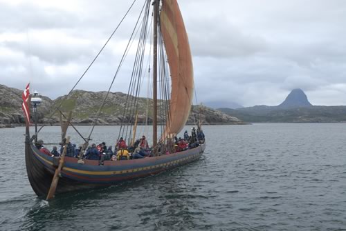
The most used sense is that of sight. Most Vikings’ travels by water took place along coasts and on rivers and streams. Visual observation, combined with knowledge of what they saw, was all that was required.
Navigation marks
The most simple ”instrument” for finding the way is actually just an artificial helping hand in navigating according to views: the navigation mark. These could be trees, burial tombs, mountains, rivers, lakes, settlements etc. The seaman would notice the changing shapes of the landscape and especially the highest point.
A good aid to remembering landscape descriptions was provided by place names, which precisely – and often using pictorial language – describe islands, hills and woods; consider for example the island of Hjelm (helmet) in the Kattegat.
Where there was a lack of easily recognisable landmarks in the landscape, these could be erected. In Danish and Norwegian they could be called tønder or varder and appear in place names such as Tønsberg and Vardø. After the introduction of Christianity, navigation marks were preferably erected in the form of a cross. A large number of these are known from place names, for example Korshavn and Korsør. At night, a fire could serve the same purpose, and in times of strife the smoke and flames from fires, so-called beacons, were used to alert the population in the hinterland in event of attack.
But the other senses could also become involved, especially close to land where the sound of birds and other animals, the smell from fires and hearths and the taste of fresh water streaming out from a water course, could all form part of the collective mental picture of the landscape.
It was possible to gain a good deal of information by observing animals. Whales search for food at particular currents or streams; birds fly only a certain distance from land. Finally, it was possible to take along birds that could indicate the direction in which land lay – just consider the Bible story about Noah's Ark.
Help from locals
In unknown waters a local man who knew the waters would have been taken on board and it became important at an early stage to be able to remember information about the landscape and pass it on to one other. This could be in the form of a – a drawing or carving, depicting a characteristic section of the landscape seen from the sea. Later, these sailing directions were written down and many of them know from early Middle Age are probably from the Viking Age.
The Sun and the Stars
The position of the sun in the sky is the basis of the function of most of the astronomical navigation instruments. But even with the human senses alone, the position of the sun, if one is used to being out in the open, gives a good idea of the location of the points of the compass. The path of the sun across the sky, and the place where it rises and sets, change with the seasons and according to which latitude one finds oneself at, but the midday direction to the south can always be found.
The stars, in particular the North Star, which remains almost motionless in the direction towards north is, at night, also a good indication of direction. But in the Nordic Countries, during the light nights when almost all voyages took place in Viking times, it is too light to observe the stars properly.
It is also possible sometimes to recognise land with the aid of the clouds that are fomed above it.